

Map 5-6: AT across Maryland and the Catoctin Trail
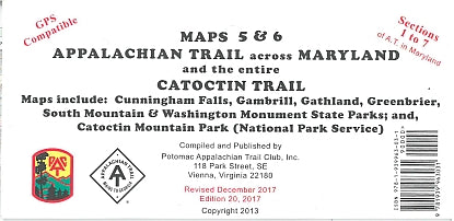
(20th edition, 2017) This edition covers Maryland Sections 1 through 7 (40.5 miles) of the A.T. as described in the A.T. Guide for Maryland and Northern Virginia. Printed on water-resistant, tear-resistance synthetic stock in 6 colors, the map shows UTM grid lines 5-KM apart on NAD83 datum making the map easier to use for those with GPS receivers. The map features the entire blue-blazed Catoctin Trail and all trails in the Catoctin Mountain Park (National Park Service) and the Cunningham Falls State Park. The scale is 1:36,360 and the contour interval is 100 feet.
(20th edition, 2017) This edition covers Maryland Sections 1 through 7 (40.5 miles) of the A.T. as described in the A.T. Guide for Maryland and Northern Virginia. Printed on water-resistant, tear-resistance synthetic stock in 6 colors, the map shows UTM grid lines 5-KM apart on NAD83 datum making the map easier to use for those with GPS receivers. The map features the entire blue-blazed Catoctin Trail and all trails in the Catoctin Mountain Park (National Park Service) and the Cunningham Falls State Park. The scale is 1:36,360 and the contour interval is 100 feet.